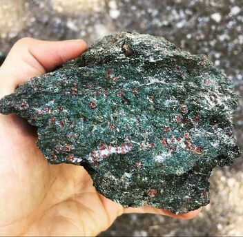
Exploring subduction using eclogites from the Yukon-Tanana Terrane, Yukon, Canada (and Alaska)
Subduction occurs when two tectonic plates collide and one sinks down beneath the other, generating earthquakes and volcanism. I study high-pressure rocks (eclogites and blueschists) from an ancient subduction zone in the Yukon-Tanana Terrane. These rocks are important because they record subduction at depths of around 60 km. The eclogites made it back to the Earths's surface, and now offer us a snapshot of the processes that might happen at depth; processes that we cannot directly observe in modern subduction zones. I study the chemical (formation and destruction of minerals with changes in pressure and temperature) and physical (deformation and potential earthquakes) processes, and the effects these two might have on one another, eventually interpreting what this might mean for tectonics.
The main methods I use for this work include field work (mapping and collection of samples), petrography (microscopy), phase equilibrium modelling (prediction of stable minerals using thermodynamics, estimation of pressure and temperatures the rocks experienced), and electron backscatter diffraction (establishing mineral orientations to understand physical deformation).
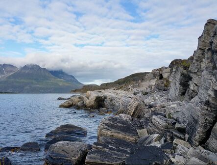
Ancient earthquakes at Fort Foster, Maine, USA
The Norumbega shear zone is a large-scale strike-slip shear zone that was active from the Early Devonian into the Permian, found today along the coast of Maine and New Brunswick, USA. A modern analog is the San Andreas fault along the coast of California, a large plate-boundary fault with the potential to generate large earthquakes. At the very southern tip of Maine (Kittery), a rare exposure of pseudotachylite networks is found. Pseudotachylites form during earthquakes when frictional heating along the fault surface causes melting. That melt freezes when sliding stops, forming a glass. They are considered the most solid evidence for earthquakes in the rock record. The pseudotachylite networks indicate a long-lived history of earthquakes. I study the the effect of metamorphism (and the associated mineral changes and fabric development) on rock strength, and the processes that drive the generation of earthquakes below the brittle-ductile transition in Earth's crust.
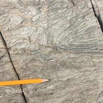
Mountain building processes in the northern Norwegian Caledonides, Norway
It is important to study how mountains form when plates collide because ongoing growth of mountains affect local climate change, generate earthquakes, and can form precious mineral deposits. This project uses the north Norwegian Caledonides to study metamorphic and deformation processes in the deepest parts of a mountain chain. I use field mapping (where are the rocks now?), phase equilibrium modelling (estimation of pressure and temperature - where were the rocks when the mountain chain formed) and age dating (the age of rocks using isotopes in minerals that formed as the mountain chain grew). Together these methods allow me to determine when and where the rocks were, and to put together a chronology of how different parts of the colliding continents interacted to form the Caledonian Orogeny. To read more go to: https://www.solid-earth.net/10/117/2019/ and https://doi.org/10.1111/jmg.12131
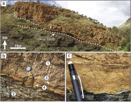
Ancient earthquakes in the Naukluft Nappe Complex, Namibia
In 2009, as part of my BSc project, I investigated a fault outcrop that had an unusual feature, a thin, sharp, opal vein parallel to the fault surface. Recent laboratory friction experiments had been found to generate silica gel on the fault surface, and it was suggested that the presence of silica gel on a fault slip surface might contribute to fault weakening and earthquakes. This was one of the first reported field examples of possible silica gel on a fault slip surface.
In 2019, 10 years later, I revisited these outrcrops as new work begins for PhD student at McGill University, Inga Boianju, understanding the large-scale nappe structure in 3D.
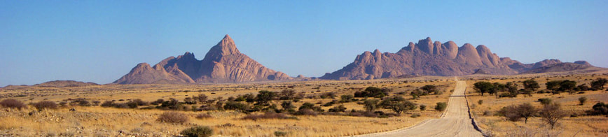
Melt migration mechanisms in the Moon Landscape, Namibia
During my MSc I completed a 2 year research project investigating the 3D structural architecture of dyke networks in migmatites in the moon landscape, 45 km east of Swakopmund. The work aimed to identify how granitic melt migrates through rocks at the outcrop scale (10's of metres) in order to understand how it might migrate through the crust from it's source (lower crust) to its sink (granitic plutons) in the upper crust. This process is important because it is how the continental crust differentiates. The work showed that the granitic melt moved through wall rocks primarily by exploiting pre-existing structures such as shear zones and boudin necks, and that the network architecture relied heavily on the wall rock properties.